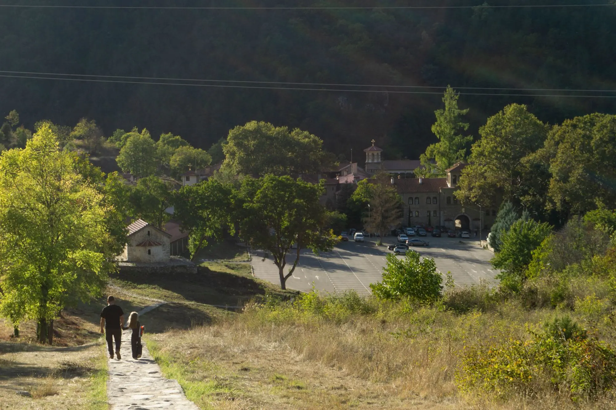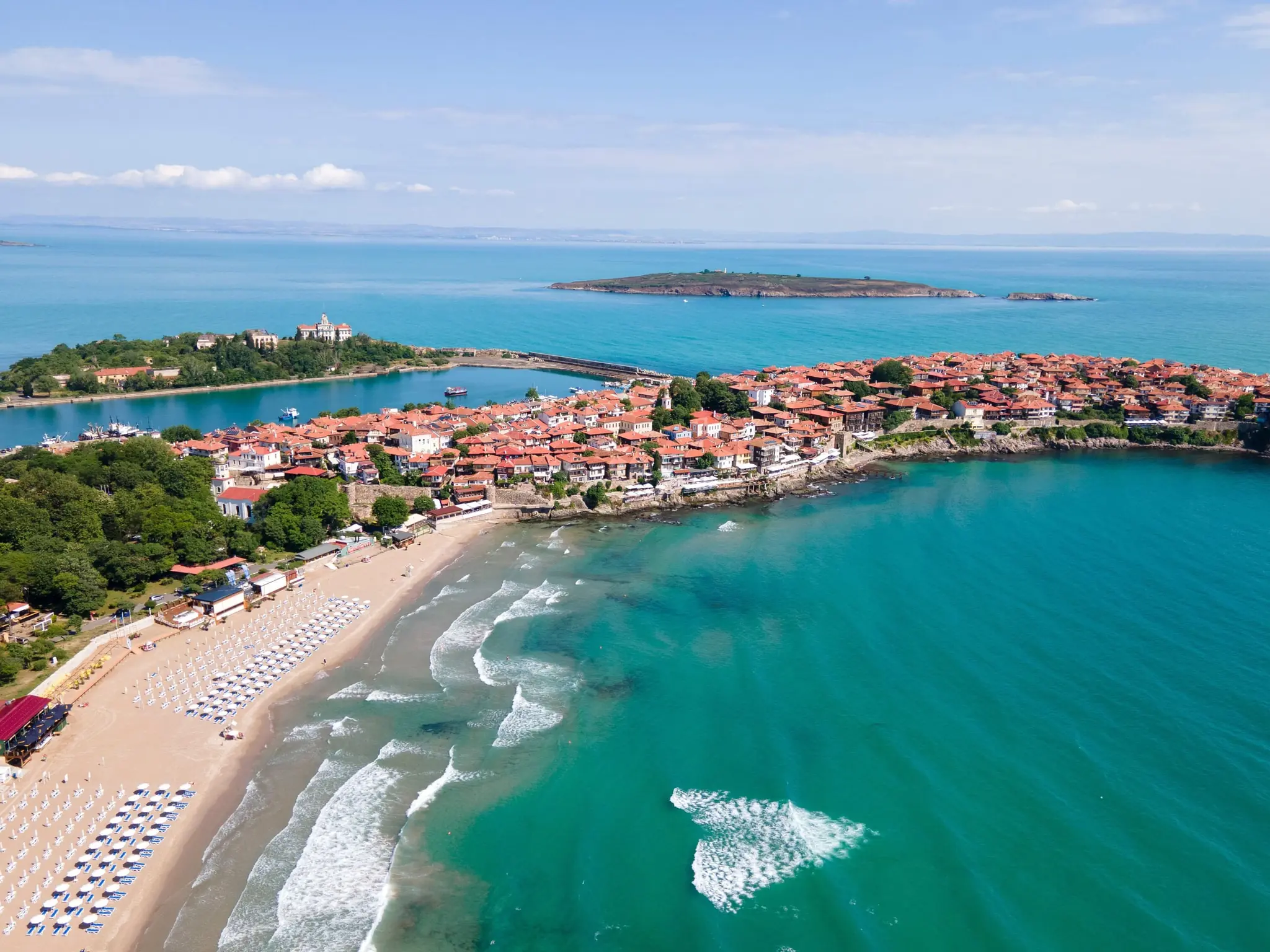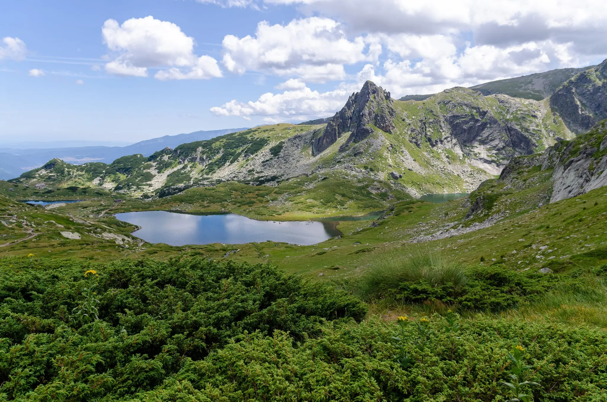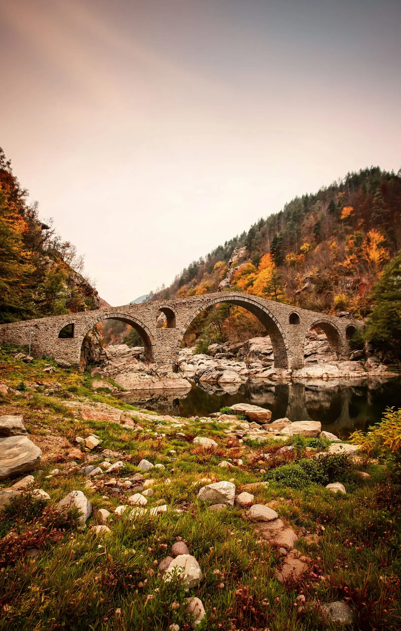
Bulgaria’s most memorable places are mostly not in its cities. They are in limestone caves with a river pouring into the dark, in red rock towers that the forest has grown around, in waterfalls that build their own stone terraces, in churches carved by hermits into a cliff above a river, and in stone villages that the railway never quite reached. Sofia and Plovdiv are the easy half of the country. This guide is about the other half.
It covers twenty-three places, each worth a few hours and several worth a night, in seven parts of the country:
- North-west: Belogradchik, Magura Cave, Baba Vida Fortress and Ledenika Cave
- North: Prohodna Cave, Devetashka Cave, the Krushuna Waterfalls and the Ivanovo Rock-Hewn Churches
- South-west: Melnik and Rozhen Monastery
- Rhodope Mountains: Shiroka Laka, the Wonderful Bridges, the Devil’s Throat Cave with Trigrad Gorge, and Yagodina Cave
- Central Balkan: Raiskoto Praskalo, the Buzludzha Monument, Dryanovo Monastery, Bacho Kiro Cave and Koprivshtitsa
- Black Sea coast: Cape Kaliakra and Balchik Palace with its botanical garden
- South-east: the rock sanctuaries of Perperikon and Tatul in the Eastern Rhodopes
They are spread across the map, so below we have joined them into one ten-day loop, with three detours for four more days. The one practical fact that decides everything is also the least glamorous: you will want a car.
These are the places Bulgaria’s trains and buses serve worst. Prohodna sits beside a country road, Trigrad Gorge has a single-lane road along the river, the Wonderful Bridges are high in the mountains, Melnik is a tiny town of fewer than two hundred people, and the sandstone rocks of Belogradchik and the Danube fortress at Vidin are a long way from anywhere. The country’s railway is very old, and it simply does not go to most of them. A car turns each place from an expedition into a pleasant drive, and it lets you arrive before the coaches and stay for the evening light.
Getting around
By car
Buses are rare
Best season
Spring to autumn
Gorges, waterfalls and mountain roads
Time needed
Ten days
Two weeks with every detour
Caves
Often guided
For entry rules, the euro, SIM cards, language and general safety, see our country guide, Discover Bulgaria: Mountains, Monasteries & the Black Sea. The cities that most trips start from have their own guides, Sofia and Plovdiv. The big monasteries and mountain lakes now live there as day trips: Rila Monastery and the Seven Rila Lakes in the Sofia guide, and Bachkovo Monastery and Asen’s Fortress in the Plovdiv guide.
Good to know: Prices and opening hours were checked in October 2026, but they change with the season, and some of these places publish nothing official. Confirm them on the official website or locally before you go; caves can also close at short notice.
The Places, Day by Day
The places are laid out as one ten-day loop that starts and ends in Sofia without covering the same road twice. Along the way there are three detours, to the Black Sea coast, Raiskoto Praskalo and the Eastern Rhodopes, which add four more days if you have the time. Under each day you will see how far you drive, and each place carries its hours, fees and tips right beneath its description. All journey times are approximate, so allow extra on mountain roads.
Tip: Bulgaria’s railway system is very old, and we don’t recommend relying on it, least of all for the places in this guide. Rent a car if you can: it is faster, more flexible, and the only comfortable way to reach most of them. The loop is paced so you never drive more than is enjoyable; if you fall behind, skip a place rather than the rest. Mountain roads are slower than the map suggests, with bends, climbs and the occasional farm vehicle, so add a margin to every journey time in this guide.
Without a car: public transport to these places is unreliable: services are few, timetables change, and for several there is nothing dependable at all. If you would rather not drive, book a trip. Shared tours are thin on the ground, and for Belogradchik, Melnik and Ivanovo in particular you may need to arrange a private driver. Availability changes with the season, so look at the current options through Experiences.
Find a trip without a car
Browse guided tours and day trips to caves, villages and monasteries across Bulgaria on our experiences page.
Browse experiencesDay 1: Ledenika and the Road to Belogradchik
Sofia → Ledenika, near Vratsa: about 2 h
Ledenika → Belogradchik: about 2 h
Straight from Sofia to Belogradchik: about 3 h
Before you set off: collect the car in Sofia on the morning of day one and return it there after day 10 rather than paying to park it through your city days. A road vignette is needed on Bulgarian roads, and our country guide explains how to buy one.
Insider tip: Caves and gorges are best early in the day. Tour groups tend to arrive in the middle of the day, so a morning start gives you the steps, the chambers and the viewpoints with room to breathe.
The north-west needs a deliberate trip rather than a stop. It is sparsely populated and economically thin, with long empty roads, and services are limited, so book your lodging and check that restaurants are open. The reward is a landscape unlike anything else in the country, a corner of red rock, caves and Danube history. This is the least visited corner of the country, which is part of its appeal.
Ledenika Cave
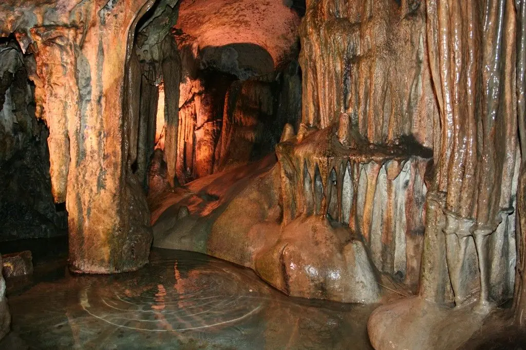
Ledenika lies about 16 km from Vratsa, in Vrachanski Balkan Nature Park, and it is a long drive from the rest of the north-west, so it fits best on the drive from Sofia to Belogradchik. It was opened to visitors in 1961 and has been protected as a natural landmark since 1962. Its name comes from the ice formations that build up near the entrance in winter and spring.
The tour goes through the Concert Chamber, a hall of formations with names such as the Crocodile and the Giant’s Head, and past a small sinter pool known as the Magic lake. The cave is open all year and is visited with a guide. The official page gives inside temperatures of up to 8 °C, so dress for the cold, however warm the day is outside.
Opening times:
| Hours | Last entry | |
|---|---|---|
| April–September | 09:00–17:00 | 16:00 |
| October–March | 09:00–16:00 | 15:00 |
Admission:
| Individual | Group (10+, with reservation) | |
|---|---|---|
| Adult | €8.20 | €6.14 |
| Student and senior | €6.14 | €5.11 |
| Child under 7 | Free | Free |
Website:
- Entry is by guided tour only, on the hour; at least two adults are needed to start a tour.
- Bring a warm layer — the cave is cold even in summer.
- Group entry and guided tours in a foreign language must be arranged in advance with the Vratsa Municipality visitor centre.
- The neighbouring amusement park has a rope park (about €3 for children, about €5 for adults), a zip line and wall climbing (about €3 per session) and a VR/360° film (about €5–7.70).
Day 2: Belogradchik and Magura
Belogradchik → Magura: about 30 min
Belogradchik → Vidin and Baba Vida: about 1 h
Belogradchik Rocks & Fortress
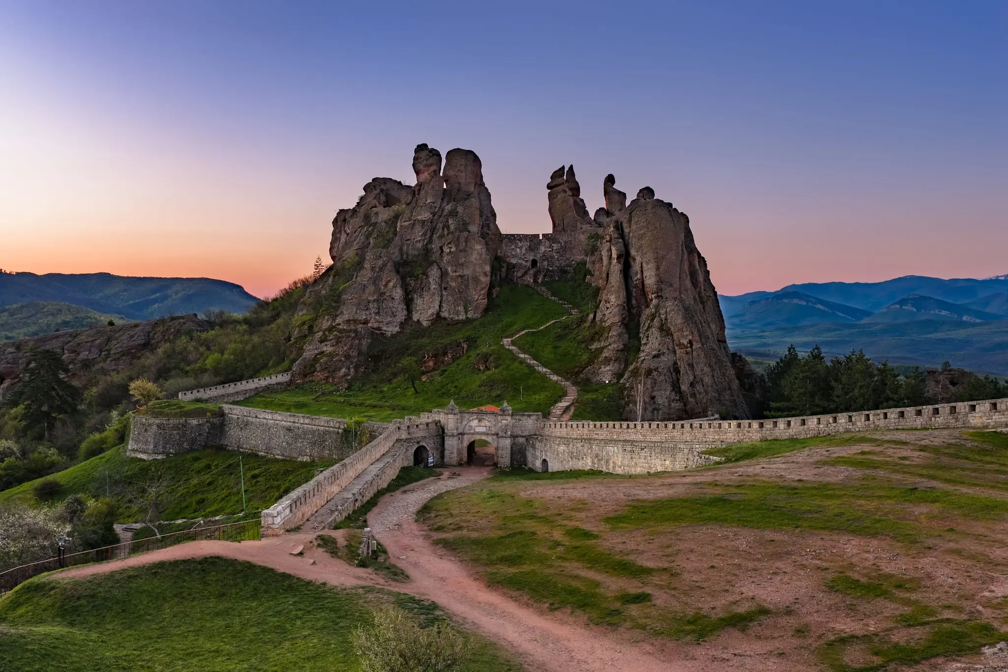
In the far north-west, red sandstone towers rise out of the forest, some of them well over a hundred metres tall. Locals have named them after figures and animals, and you will hear the names as you walk.
The fortress, known as Kaleto, is built right into the rocks themselves. Its origins are Roman, medieval rulers extended it, and the Ottomans rebuilt it in the nineteenth century. Climb its terraces and ramparts for a view over the whole formation, and stay for sunset, when the best light falls and the towers glow deep red. Go early in summer to avoid midday heat, as the stone absorbs it.
Opening times:
| Period | Hours |
|---|---|
| 1 May–14 September | 09:00–20:00 |
| April and 15–30 September | 09:00–19:00 |
| October | 09:00–18:00 |
| November–March | 09:00–17:00 |
Admission:
Adult – €7.67 / Student – €6.14
Combined ticket with Magura Cave – €12.27
Website:
- Open daily; last entry is one hour before closing.
- Expect many steps and uneven rock.
Magura Cave
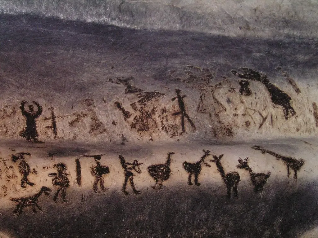
Magura Cave is the natural companion to Belogradchik. Large chambers and a steady cool temperature make it memorable, and its walls carry prehistoric paintings made with bat droppings. Their age is debated, but the images of figures and animals are a rare sight.
It is best seen on a guided tour, and the standard route may not include every painting. Give the fortress a morning and the cave an afternoon, or the other way round. It is a very good reason to make the long drive to the north-west.
Opening times:
April–October – 09:00–19:00
November–March – 09:00–17:00
Admission:
Adult – €7.16
Combined ticket with Belogradchik Fortress – €12.27
Website:
- Bring a warm layer and shoes with grip. Visits are guided, so check the tour schedule before you drive.
Baba Vida Fortress (Vidin)
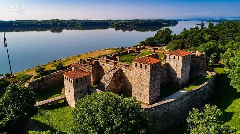
The Danube town of Vidin, with the bridge across the river to Romania, is about an hour away and fits the end of the day, and its riverside fortress of Baba Vida is the reason to stop. It stands on the Danube bank on the remains of the Roman town of Bononia, with nine towers, loopholed walls and a moat that is sometimes filled from the river. Medieval construction began in the second half of the 10th century, and most of what you see today dates from the Second Bulgarian Empire.
After 1878 the army used the fortress, and it opened to visitors in 1958 as a museum. It was declared a monument of culture of national significance in 1964. Inside, a prison exhibition shows torture devices and figures of an executioner and a prisoner, and there are cannons and a gallows on a terrace. A summer theatre is staged in the fortress. According to one version of the legend, the name belongs to Vida, the eldest daughter of a rich boyar, who turned away her suitors and built the castle to live in. Curator talks are given in Bulgarian only.
Opening times:
| Weekdays | Weekends | |
|---|---|---|
| Summer | 08:30–19:00 | 09:30–18:00 |
| Winter | 08:30–16:30 | 10:00–16:30 |
Admission:
Adult – €6.20 / Student and pupil – €3.10 / Senior – €3.10
Family ticket (parents with children aged 7–18) – €15.50
Website:
- Curator talks are in Bulgarian only.
- Hours differ between sources, so confirm them locally before you go.
- The western bastion is being reinforced and access may be limited.
Day 3: Prohodna and Devetashka Cave
Belogradchik → Prohodna: about 3 h
From Sofia: Prohodna is about 112 km, roughly an hour and a half
The first three places sit on the road between the capital and the Danube plain, and they are the easiest of the natural sights to reach from Sofia. Together they make a good break on the long drive between the north-west and the north-east. Prohodna is the nearest to Sofia, and Devetashka and Krushuna can follow on the same afternoon or the next morning.
Prohodna Cave (Eyes of God)
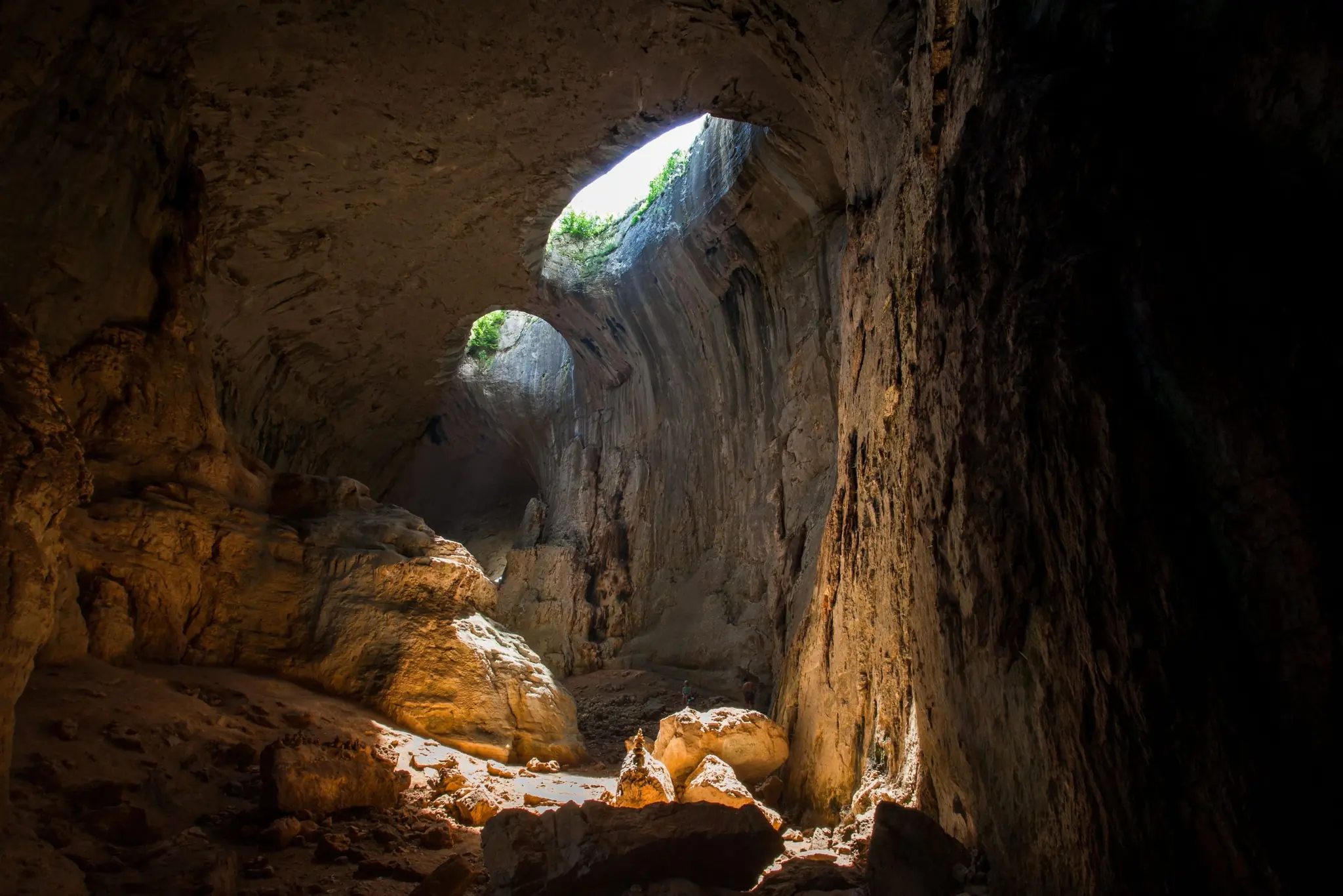
Prohodna is less a cave than a natural rock tunnel, 262 metres long, with entrances about 35 and 45 metres high. You park by the small entrance, walk into the tunnel and keep looking up: the two round openings in the roof, which Bulgarians call the Eyes of God, throw pale light across the floor.
It is a protected natural landmark near the village of Karlukovo, and has been since 1962. People have lived in and around the cave since the Neolithic and Chalcolithic periods. The walk through takes only 20 to 30 minutes, though most people stay far longer to look up. Allow an hour or more to look around, because the area is full of paths and rock faces. Some private operators run bungee jumping and climbing from the larger entrance.
Opening times:
Open 24 hours, all year
Admission:
Free
Website:
- The cave is not lit, so bring a torch and sturdy, non-slip shoes. In winter the ceiling grows icicles and the ground is slippery.
Devetashka Cave
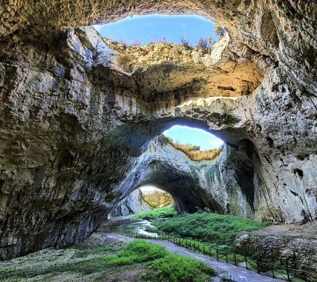
Devetashka Cave is a vast cave about 16 km from Lovech, where the Osam river runs through an entrance some 35 metres across and about 2.4 kilometres of passages. The central hall, up to 60 metres high, is lit from above by seven openings in the ceiling.
People lived here from around 70,000 BC, and the Copper Age settlement was the largest. It is a protected natural landmark, open daily with shorter winter hours. Parts of it close for part of the year, so find out which sections are open before you go. It is roughly 10 km from Krushuna, so the two combine easily.
Opening times:
Summer – daily 08:00–20:00
Winter – daily 09:00–16:00
Admission:
Adult – €1.53
Student, senior or group – €1.02
Family ticket (children 7–18) – €3.07
Website:
- Parts of the cave close for part of the year: the dry gallery from 25 May to 31 July and the wet gallery from 1 November to 1 April, while the lit section stays open all year. Wear shoes with grip, and bring a torch if you go beyond the lit section.
Day 4: Krushuna and Ivanovo
Prohodna → Krushuna: about 1 h 30
Krushuna → Ivanovo: about 2 h
Ivanovo → Ruse, for the night: about 20 km
From Sofia: Krushuna is about 200 km, 2 h 30 – 3 h
Krushuna Waterfalls
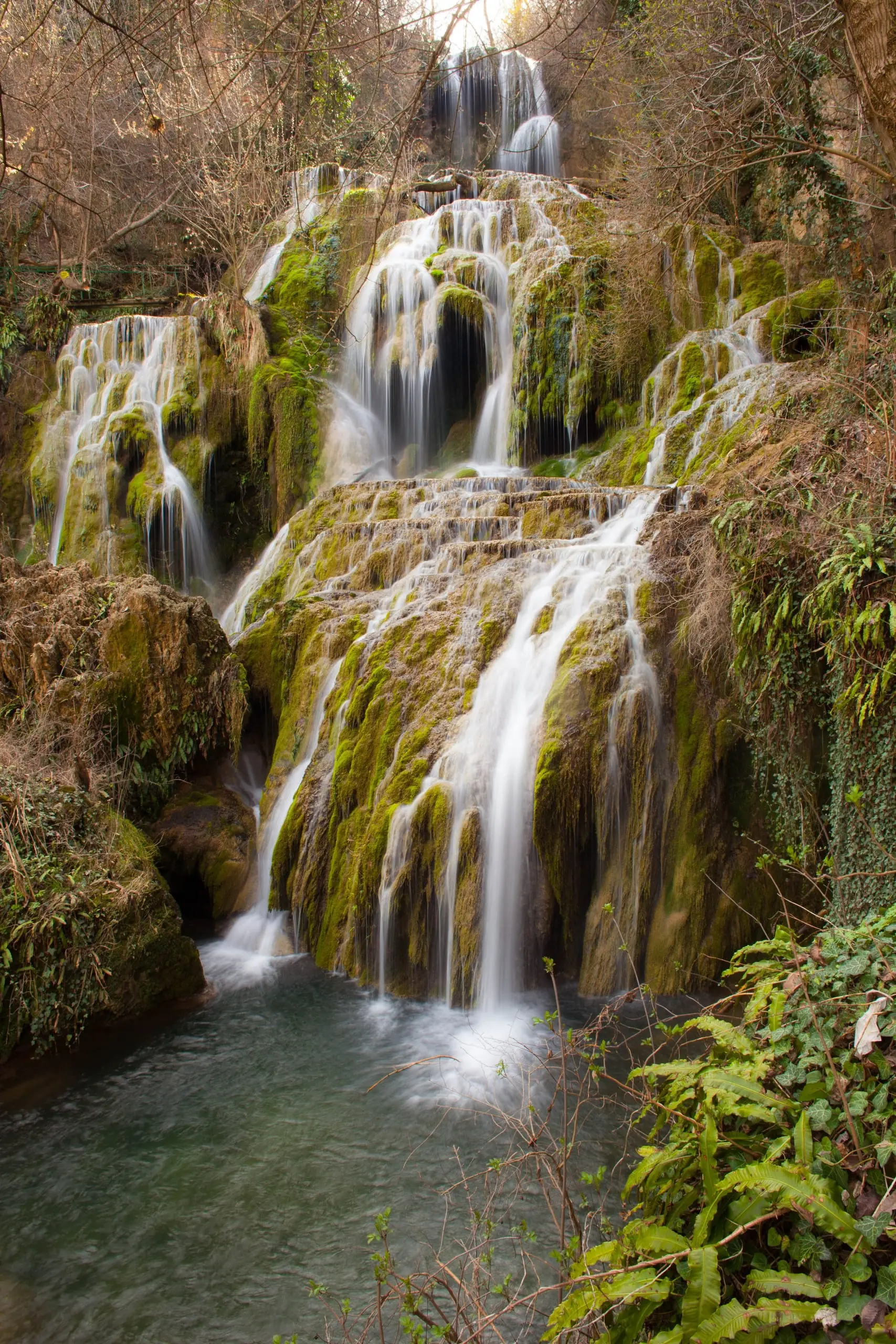
At Krushuna the Proynovska river builds travertine terraces, pale ledges of a stone it makes itself, that hold turquoise pools shaded by trees, and the water drops from one to the next in a long series of small falls. These are said to be the largest travertine cascades in Bulgaria.
The falls lie about a kilometre from Krushuna village, and from the car park it is a walk of roughly 400 metres, about ten minutes, so this is an easy stop. The falls are strongest in spring, and by early autumn they are quieter and the paths less busy. In winter the paths are muddy or icy. Near the falls, the river emerges from a cave called Maarata, and the remains of a medieval hermit monastery of the thirteenth and fourteenth centuries survive nearby.
Opening times:
08:00–20:00
Admission:
Adult – around €2.50 / Student – around €1.50
- Wear shoes with grip, because the stone is wet and mist-slick. Take care in high water, and expect mud or ice in winter.
Ivanovo Rock-Hewn Churches
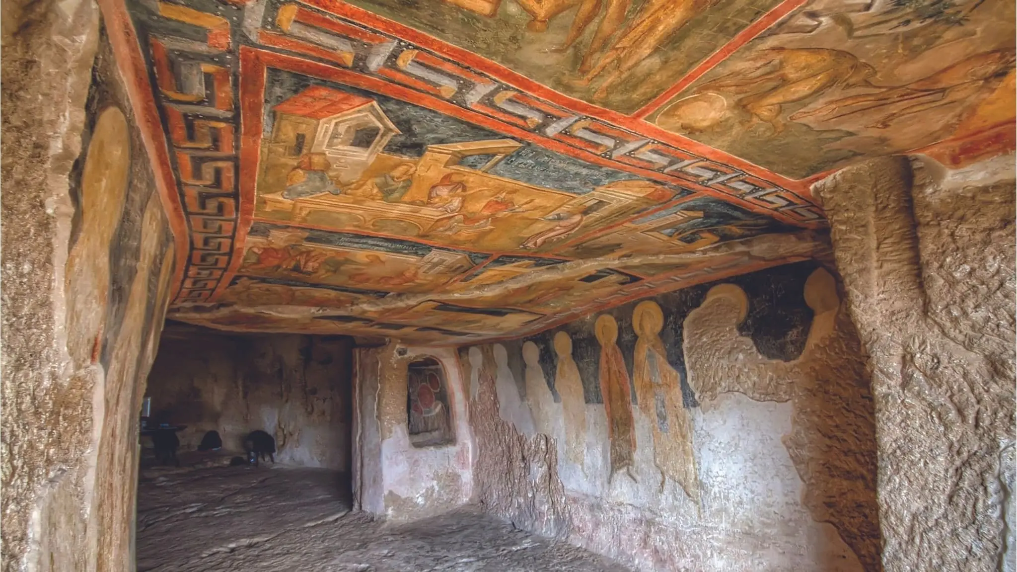
In the valley of the Rusenski Lom, a tributary of the Danube, medieval monks cut a monastery into the limestone cliffs, with chapels, cells and churches about 32 metres above the water. The complex is said to have begun in the 1220s, and it reached its height in the fourteenth century, when it was a centre of the hesychast movement, a tradition of silent, contemplative prayer. At its peak there were around forty churches and some three hundred other rooms, and most were lost over the centuries.
What does survive is painted. The Church of the Holy Mother of God is the most impressive, with the most striking frescoes, and the so-called Buried Church shows Tsar Ivan Asen II offering a model of the church to the saints. The murals, painted in the fourteenth century, belong to the artistic school of Tarnovo, and the site is a UNESCO World Heritage Site. Most of the churches lie on the right bank of the river, in an area known as Pismata. A visit means a walk along a gorge path with some steps.
The site is open from April to October, and is closed to ordinary visitors in winter, when only organised groups can enter. A guided tour in English costs extra.
Opening times:
1 April–31 October – daily 09:00–18:00
Last entry – 17:30
1 November–31 March – closed to regular visits (organised groups only, booked in advance)
Admission:
| Ticket | |
|---|---|
| Adult | €5 |
| Student or senior | €2.50 |
| Group of more than five | €3 per person |
| Guided tour in English | €12.50 |
| Under 7, visitors with disabilities | Free |
Website:
- Wear sturdy shoes for the steps and gorge path.
Detour: the Black Sea Coast (Two Days, or One Long Day)
Ruse → Balchik: about 3 h
From Varna: Balchik is about 50 km to the north, and Kaliakra lies about 12 km south-east of Kavarna
From here to Dryanovo: about 3 h 30
If you have two more days, drop down from Ruse to the sea before you carry on to the Balkan range.
The northern Black Sea coast is a different Bulgaria from the resorts to the south: chalk cliffs, a steppe plateau and a garden by the sea. A car makes it easy to take both places in a long day, and the evening light on the cape is the reason to stay late.
Cape Kaliakra
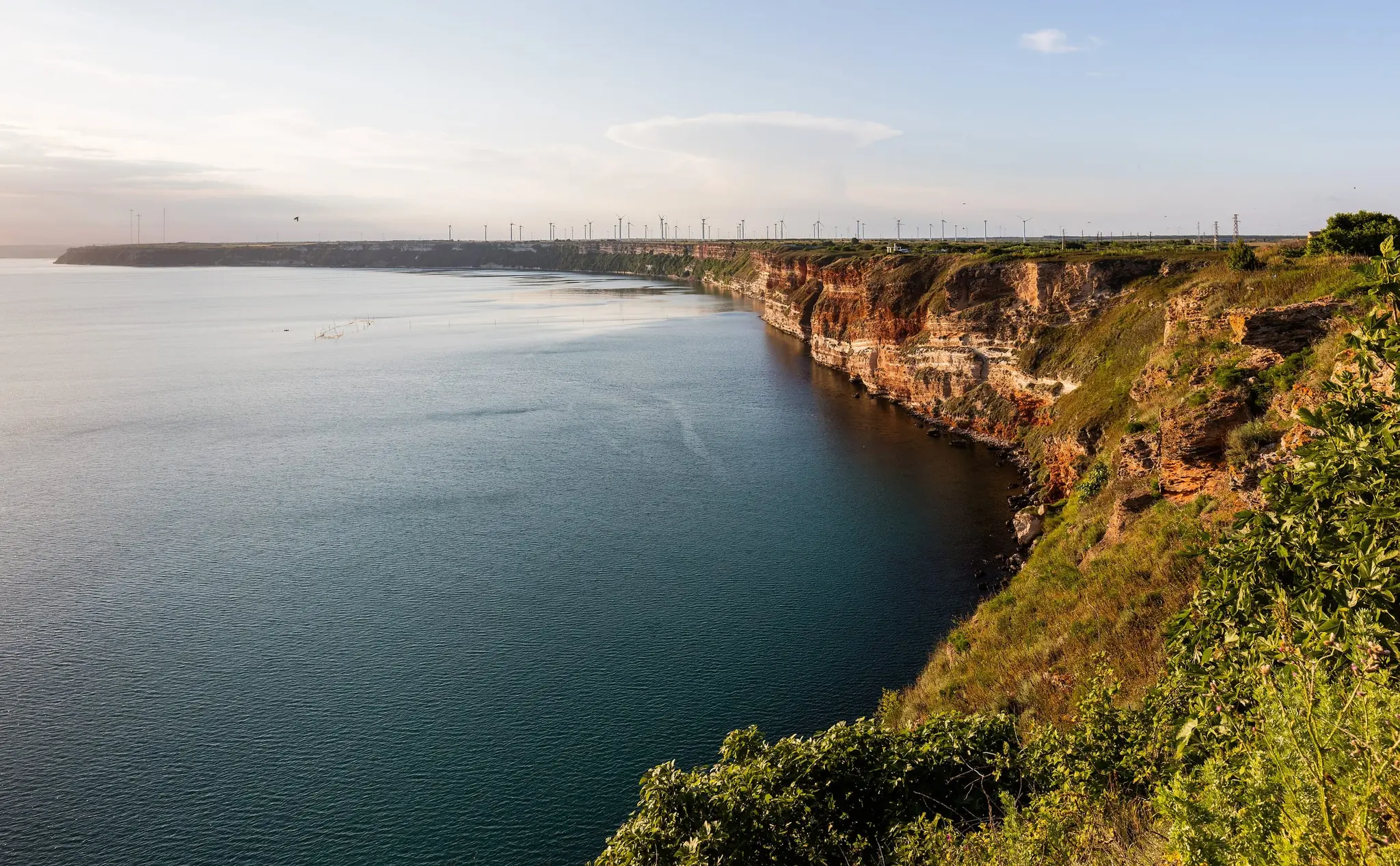
Cape Kaliakra juts about 2 km into the sea, and its cliffs drop 60 to 70 metres to the water. It has Thracian roots, a 440-metre wall across the land side, and the remains of a medieval fortress, and its name means "beautiful cape". A small museum sits in a cave on the cape. The cape has been a protected area since 1941, and the fortress was declared a monument in 1967. It lies about 12 km south-east of Kavarna.
The cape is best known for a legend. When the Ottomans overran this coast in the late fourteenth century, forty Bulgarian girls are said to have braided their hair together and leapt from the cliffs rather than be taken captive. A memorial at the entrance to the cape, the Gate of the 40 Maidens, recalls them. In one version of the tale a woman named Kaliakra led them and the cape took her name, though the name itself comes from the Greek for “beautiful cape”. Standing on the edge, with the sea far below, it is easy to see why the story has lasted.
Opening times:
Reserve and cliffs:
Open all year
Summer – daily 09:00–19:00
Off-season – typically 09:00–17:00
Cave museum:
Daily, May–October
Admission:
Adult – about €3 / Child and student – about €1.50
Website:
- Stay on the paths near the cliff edge. Go in the evening light, because summer is crowded.
Balchik Palace and Botanical Garden
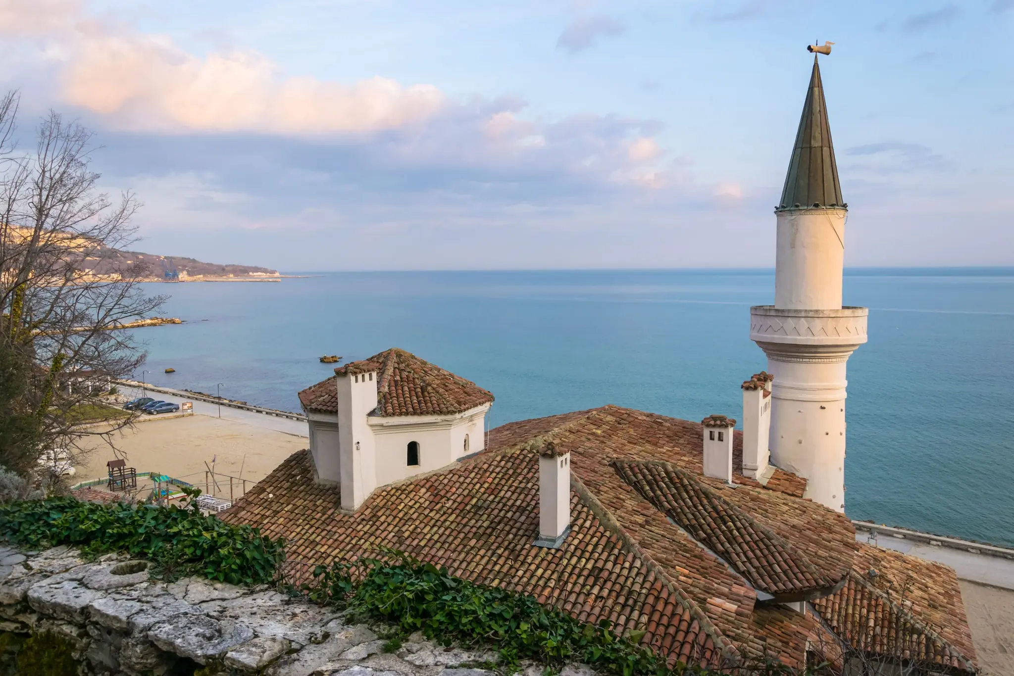
Balchik Palace began as a royal whim. Romania took this stretch of coast in 1913, and Queen Marie fell for the whitewashed town above the sea, so she had a summer retreat built here between 1924 and 1936, about 50 km from Varna. She loved it so much that when she died in 1938 her heart, not her body, was placed in the small Stella Maris chapel in the garden, in a golden casket. In 1940, when the region returned to Bulgaria, the heart was taken back to Romania.
The botanical garden that grew around the palace is the main draw, with terraces down to the water and a cactus collection that is reportedly one of the largest in Europe. The estate is open all year, but the garden is at its best from spring to early autumn.
To see the whole complex you need two separate tickets, one for the botanical garden and one for the palace, bought at two consecutive ticket desks. The Varna guide has a short Balchik day-trip note, and the Burgas coast guide covers the south coast.
Opening times:
| Period | Hours |
|---|---|
| April | 08:30–19:00 |
| May–August | 08:00–20:00 |
| September | 08:00–19:00 |
| October | 08:30–18:00 |
| November–March | 08:30–17:00 |
Admission:
| Botanical garden | Palace | Both | |
|---|---|---|---|
| Adult | €10 | €10 | €20 |
| Student | €3.60 | €3 (aged 6–18) | €6.60 |
| Senior | €3.60 | – | – |
| Family | €20 | €18 | €38 |
| Child | Free up to 4 | Free up to 6 | Free |
Website:
- Open daily, all year.
- Pay in cash, in euros, at most ticket desks. Parking near the palace costs about €1.50–€2.50. Summer is crowded, so arrive early, and allow time for the garden as well as the palace.
Day 5: Dryanovo
Ruse → Dryanovo: about 2 h
Veliko Tarnovo or Gabrovo make a handy base for the middle of the range
The Balkan range runs through the middle of the country, and this stretch has a mountain waterfall, the Buzludzha monument, and a monastery and a cave side by side. Not all of the places are close together, so the loop spreads them over two days, with the waterfall left as a detour for anyone with a day to spare.
Dryanovo Monastery
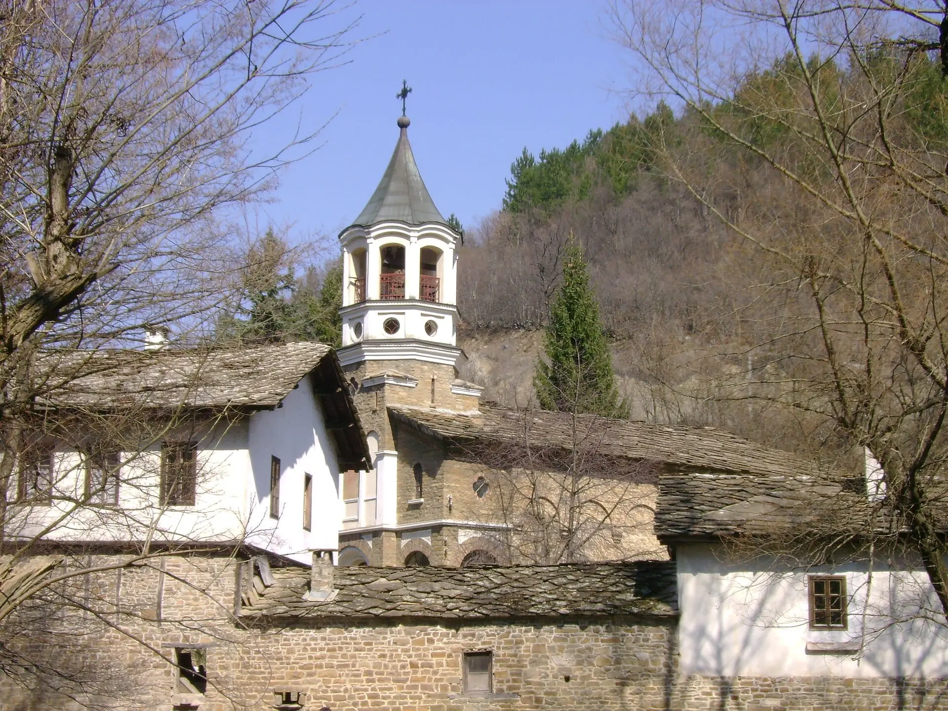
Dryanovo Monastery is tucked into the wooded Andaka valley of the Bulgarka Nature Park, a few kilometres from the town of Dryanovo on the road to Gabrovo. It is a quiet place with a loud history. The Ottomans burned it in 1393, it rose again, and in 1876 it became a rebel stronghold of the April Uprising, where the band of Bacho Kiro, the man the neighbouring cave is named after, took refuge in April. According to one account, around 195 insurgents held out for nine days against an army of several thousand, and only a few dozen slipped away. The monastery was wrecked again afterwards, and its main church was consecrated in 1877. An ossuary of 1897 still holds the rebels’ bones, and a museum on archaeology and the Revival keeps the April Uprising at its centre. The monastery has been a national monument of culture since 1971.
The cave of Bacho Kiro is only about 300 metres away, so the two make one stop.
Opening times:
Daily, 08:00–20:00
Admission:
Free (courtyard and church)
Website:
- Dress modestly and ask before taking photographs inside. Pair it with Bacho Kiro Cave next door.
Bacho Kiro Cave
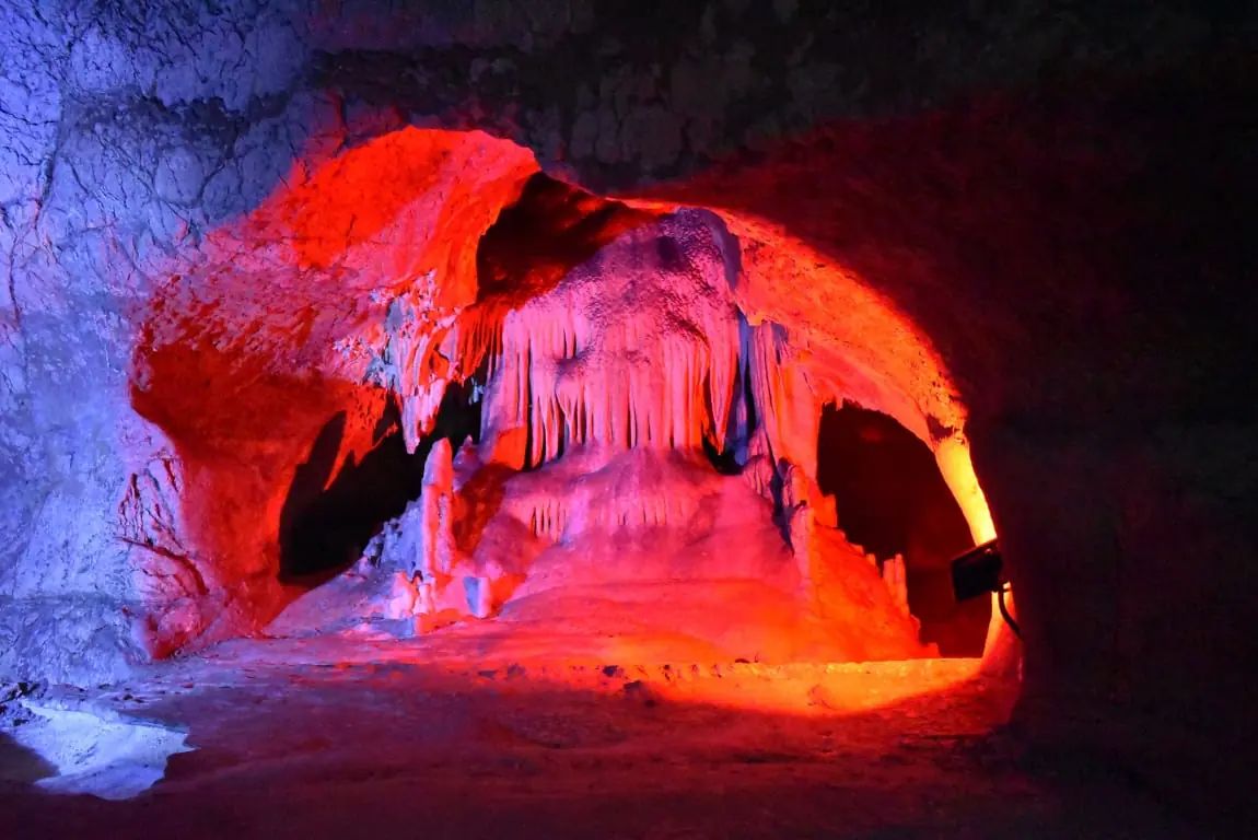
Bacho Kiro Cave has about 3,600 metres of galleries on four levels, of which about 700 metres are open to visitors. It was opened to visitors in 1938 and named after the revolutionary Bacho Kiro in 1940. Visits are guided only, on a short route of about 25 minutes or a long one of about 60 minutes, and the halls carry names such as the Rain Hall and the Concert Hall.
Its galleries were cut by an underground river and are lit electrically, and some of the formations have been given names: Bacho Kiro’s Throne, the Dwarfs, the Sleeping Princess and the Throne Hall.
The cave also matters to archaeologists. It has given up the oldest human remains found in Bulgaria: two fragments of jaw, about 46,000 years old, which a 2020 study in the journal Nature identified as Homo sapiens, among the earliest known in Europe. Two pierced animal teeth from the same period, more than 43,000 years old, are described as the oldest known ornaments in Europe, so people were already making jewellery in this valley more than 43,000 years ago.
Opening times:
Daily, April–October – 09:00–18:00
Daily, November–March – 10:00–16:00
Admission:
| Short route (20–25 min) | Long route (60 min, guided) | |
|---|---|---|
| Adult | About €5 | About €6 |
| Student and senior | About €2.50 | About €4 |
| Family (2+2) | About €10 | – |
Website:
- Visits are guided, so check the tour times. Bring a warm layer.
Day 6: Buzludzha and the Road to Kalofer
Dryanovo → Buzludzha: about 1 h
Buzludzha → Kalofer, for the night: about 1 h
Buzludzha Monument
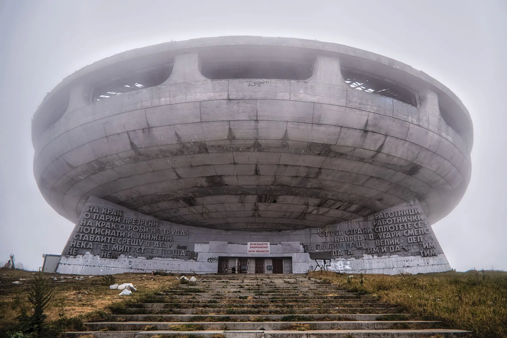
The Buzludzha Monument is a saucer-shaped hall of the communist era on a 1,432-metre peak, designed by the architect Georgi Stoilov. Built from 1974 and opened on 23 August 1981, it marks the 1891 gathering behind the Social Democratic movement. It has stood abandoned since 1989, and that is much of the appeal: a flying-saucer silhouette on the ridge, a tower about 70 metres high topped with a red star, and a nickname, “Bulgaria’s UFO”. Photographers and urban explorers have been making the trip since the mid-1990s.
The inside is officially closed, and visiting it is prohibited. The Buzludzha Project foundation, founded in 2015, works to save the building. It was named on the Europa Nostra list of endangered heritage in 2018 and received Getty grants in 2019 and 2020. Restoration work, on the roof, windows and mosaics, has been reported in 2026. The exterior and the summit are open access, and two roads lead up from the Shipka Pass: one of 16 km from Kazanlak and one of 12 km from Gabrovo.
Opening times:
Open access, exterior only
Admission:
Free
Website:
- Do not go inside: the building is structurally unsafe. Check road and weather conditions, because it can be foggy and cold at 1,400 metres.
Detour: Raiskoto Praskalo (One Day)
A full day on foot from Panitsite near Kalofer
If you have a spare day in the mountains, from Kalofer you can walk to Bulgaria’s highest waterfall.
Raiskoto Praskalo Waterfall
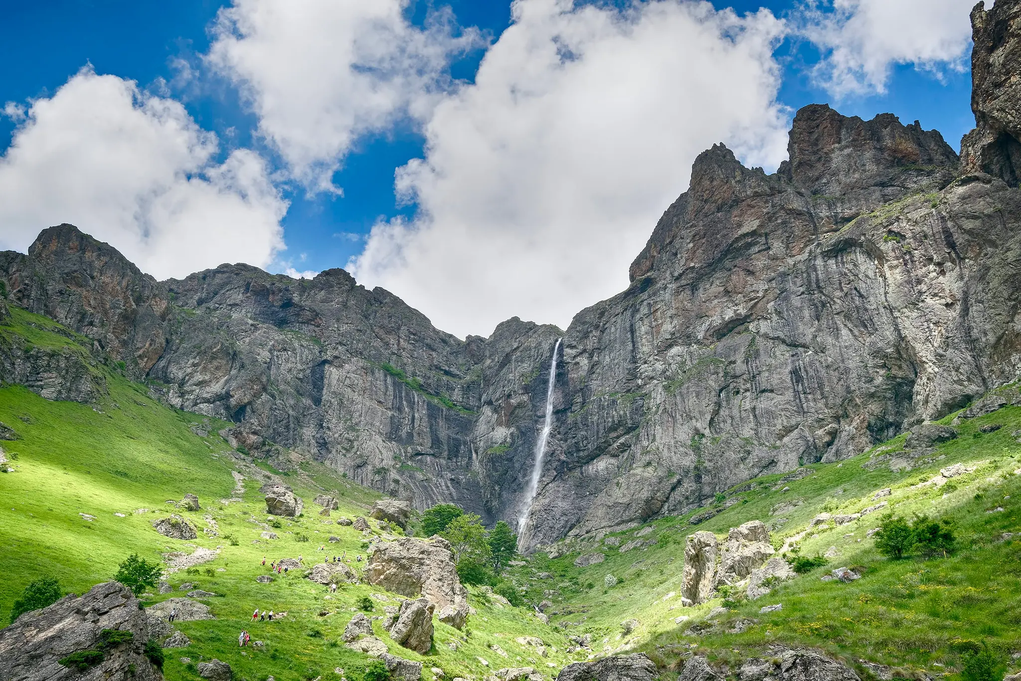
Raiskoto Praskalo is Bulgaria’s highest waterfall, a single drop of about 124 metres in the Central Balkan National Park above the town of Kalofer. It is usually described as the highest permanent waterfall in the country, and on a clear day it can be seen from Kalofer itself.
The usual route starts at Panitsite, near Kalofer, and climbs about 10 km through forest and meadow to the Rai hut (120 beds), which stands at the foot of the falls. From the hut it is a further 20 to 30 minutes on foot, steep in places. Allow most of a day for the round trip, or sleep at the hut to split the walk. The flow is best after rain or snowmelt, but reports differ on the season, so check locally. The park has at times restricted leaving the marked trails, so check with the park office before you go.
Opening times:
Open trail – check conditions locally
Admission:
Free
Rai hut, per night:
Standard bed – about €18
Bunk bed – about €15
Own tent (outside the hut, with permission) – about €8 per tent
- This is a long mountain hike, not a short walk. Wear proper hiking boots, carry layers and water, and start early.
- Rai hut is booked by phone (+359 882 966 491) or at td.haidut.kalofer@gmail.com; there is no online booking. The hut serves hot soups, tea, coffee and beer, at roughly €3–€7 a meal.
- Parking at Panitsite is about €2.50–€5 a day. By train to Kalofer (about €3.50 from Sofia or Plovdiv), you will need a taxi or the local minibus up to the town and Panitsite.
Day 7: Koprivshtitsa
Kalofer → Koprivshtitsa: about 1 h 30
From Sofia: about 2 h
Koprivshtitsa
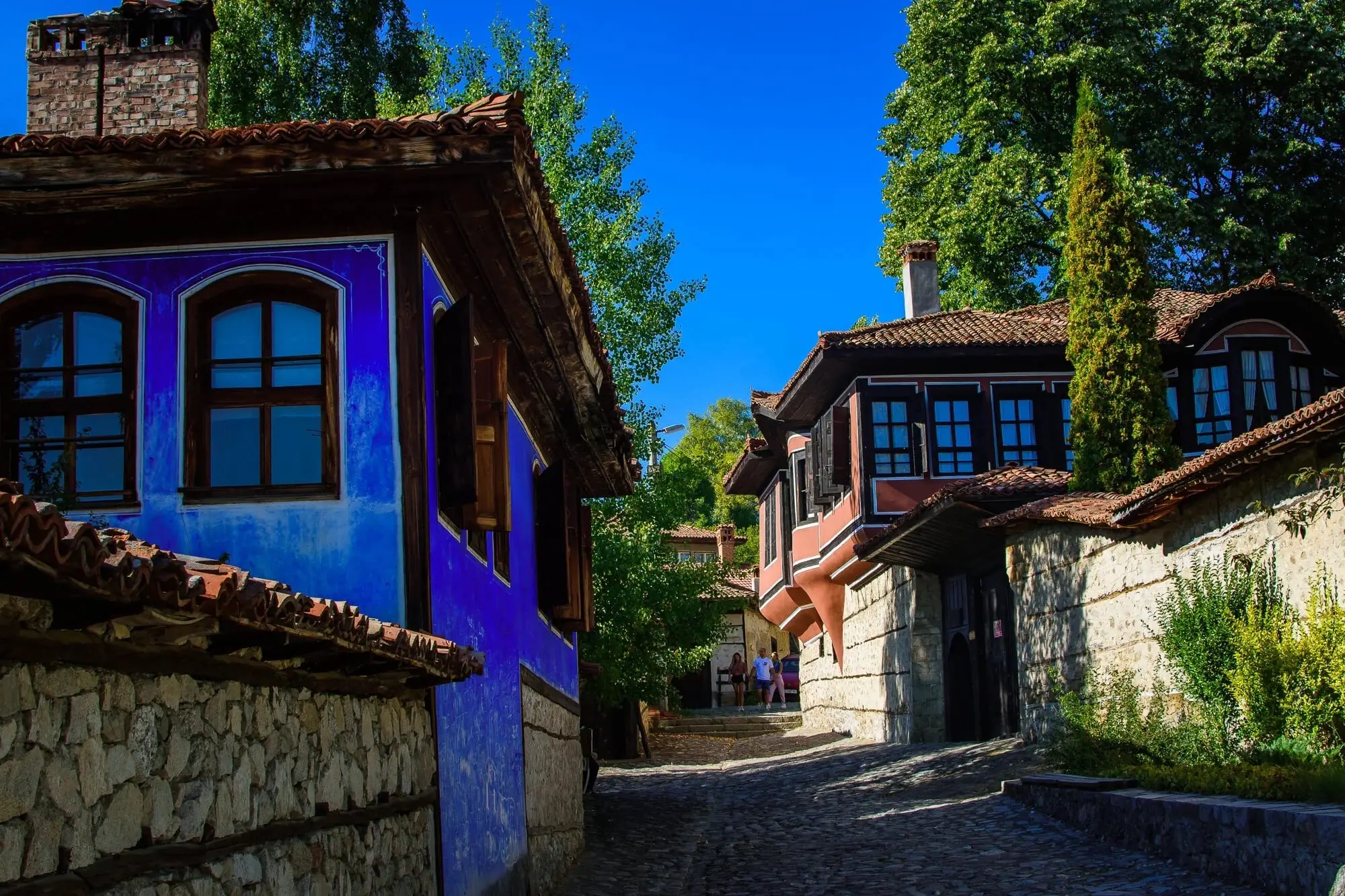
Koprivshtitsa is a town where the nineteenth century has been kept on purpose. Tucked into the Sredna Gora hills at roughly a thousand metres, about two hours east of Sofia, it is a maze of cobbled lanes, arched stone bridges and painted Revival houses with upper floors that jut out over the street on carved wooden supports. Behind the high walls are courtyards, and behind the courtyards, rooms with painted walls and ceilings carved like lace.
It is also where the April Uprising of 1876 began. The local revolutionary Todor Kableshkov sent the "Bloody Letter", a note to the revolutionaries of Panagyurishte announcing that Koprivshtitsa had risen and urging them to follow. It is said to have been signed with the blood of the Ottoman governor killed that day, and the Kalachev Bridge is where the first shot is said to have been fired. Pair a grand merchant house such as Oslekov House with a revolutionary one such as Kableshkov House, and walk the bridges between them. Two or three houses are plenty, and since 1965 the town has hosted a national folk-music festival.
Opening times:
The six house-museums:
Summer (May–October) – daily 09:30–17:30
Winter (November–April) – daily 09:30–17:00
Each house closes one or two days a week, mostly Monday and Tuesday, but they take turns, so a few are always open
Admission:
| Combined ticket (6 houses) | Single museum | |
|---|---|---|
| Adult | €10 | €5 |
| Student or pensioner | €5 | €3 |
| Family (children under 18) | €20 | – |
| Guided talk | €20 | €5 |
Website:
- The combined ticket covers six museums: the houses of Kableshkov, Benkovski, Debelyanov and Karavelov, Lyutov House and the Museum of Education. Oslekov House is run separately.
- An audio guide in seven languages costs about €15 a day. Entry is free for visitors with disabilities, and for everyone on the last Monday of each month.
Detour: the Eastern Rhodopes (One Day, or a Night in Kardzhali)
Koprivshtitsa → Kardzhali: about 3 h
From Kardzhali: Perperikon is about 15 km to the north-east, and Tatul about 15 km east of Momchilgrad
Kardzhali → Shiroka Laka: about 2 h
If you have not seen the rock sanctuaries on our Thracian heritage trail, turn off to Kardzhali on your way to the Rhodopes.
The eastern end of the Rhodopes is drier, emptier and more open than the pine hills around Smolyan, and its bare ridges hide holy places cut straight into the rock. Our Thracian heritage trail puts both in the wider story.
Perperikon
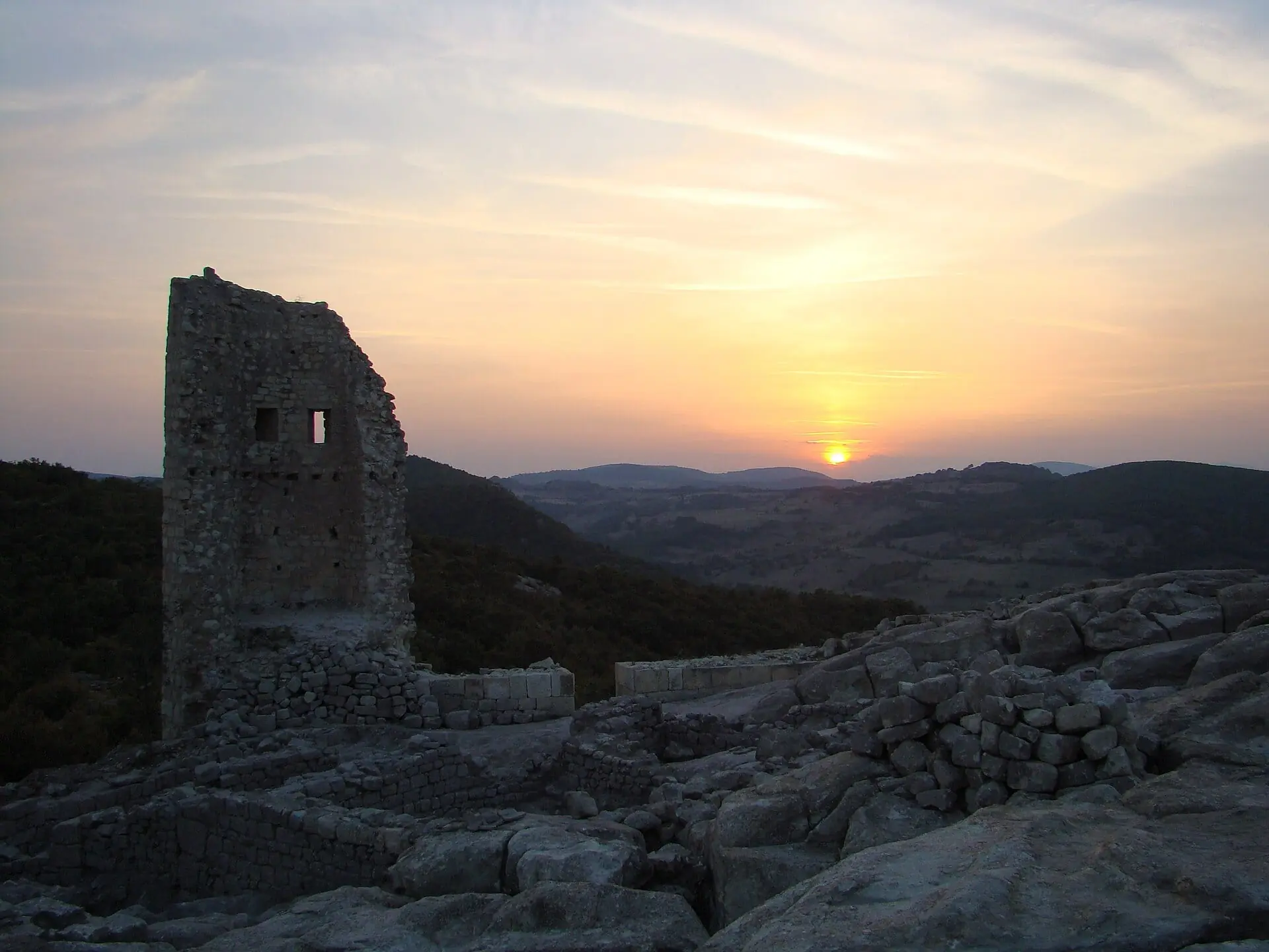
From a distance Perperikon looks like an ordinary rocky hill, until you notice the steps, the channels and the rooms cut into the stone. People have been drawn to this hill for thousands of years, with traces of human activity in the area reaching back to about 5000 BC. Excavations led by Nikolay Ovcharov, which began in 2000, found a round altar almost 2 metres across hewn out of the rock, a Roman-era fortress with walls up to 2.8 metres thick, and a medieval stronghold that was abandoned in the fourteenth century.
Ovcharov links the hilltop to the famous oracle of Dionysus mentioned by ancient writers, a popular but debated identification, and it comes with two good stories. In the first, the oracle told the young Alexander the Great in 335 BC that he would conquer the known world. In the second, told by Suetonius, the father of the future emperor Augustus asked the oracle about his son and got the same answer.
Opening times:
Summer (May–September) – daily 08:00–20:00
Winter (October–April) – daily 08:30–18:00, or until dusk
Admission:
| Ticket | |
|---|---|
| Adult | About €7 |
| Student, pupil or senior | About €3 |
| Family (2 adults + 2 children) | About €15 |
| Child under 7 | Free |
Website:
- The climb is steep, about 30 minutes uphill over uneven stone steps, so wear shoes with grip, not flip-flops. The rock has almost no shade, so go early or late in summer and carry water. Allow about two hours. Car parking is about €1.
Tatul
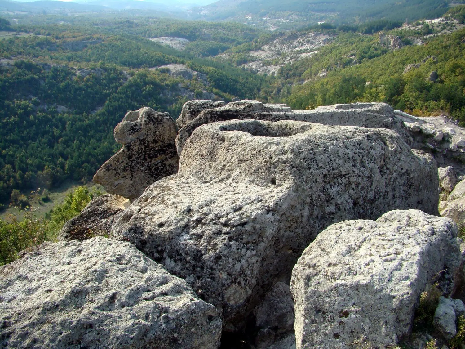
About 200 metres from the village of Tatul, a rock shaped like a truncated pyramid rises above a ring of clay altars, with two sarcophagi, a rectangular bed for the main altar and a well three metres deep. The place is also called Orpheus’ Sanctuary, and some researchers say its sarcophagus, pyramid and side chamber illustrate the funerals of Orpheus and King Rhesus of Thrace, a link that remains debated.
Ancient writers disagree on where Orpheus was buried, naming places such as Pieria and Dion at the foot of Mount Olympus, and the idea that his grave lies here only dates from the 1970s, when some Bulgarian historians guessed it. Excavations in 2004–2007 turned up three model wheels of a heavenly chariot and part of a gold mask, and in 2011 an online vote named Tatul one of the "10 Wonders of Bulgaria". Sources date the sanctuary differently, from the late 5th century BC to far earlier, so treat the dates as open.
Opening times:
Summer – daily 09:00–20:00
Winter – daily 09:00–17:00
Admission:
| Ticket | |
|---|---|
| Adult | About €3 |
| Student or senior | About €1.50 |
| Guided talk | About €13 |
- Guides give their talks in Bulgarian only. The ground is uneven limestone, so wear shoes with grip, and there is almost no shade.
Day 8: Shiroka Laka and the Wonderful Bridges
Koprivshtitsa → Shiroka Laka: about 3 h
From Plovdiv: about 2 h to Smolyan
The Rhodopes are older and gentler than Rila and Pirin, a rolling range of pine forest, river gorges and stone villages whose roofs are made of heavy slabs. The area was the heartland of the ancient Thracians, and Orpheus, the mythical singer, is said to have walked these hills. Folk music is alive here in a way that you notice quickly. Bagpipes, called gaidas, and the slow, droning songs of the region belong to village life rather than to a festival stage.
A good Rhodope trip has four beats: a village to sleep in, a high-mountain outlier, a dramatic gorge and a long, quiet cave. Smolyan, the regional town, is functional rather than pretty and makes a handy base; for lodging, our Pamporovo stay page also covers sleeping in Smolyan, about 15 km below the ski resort, with prices compared. If you would like thermal water, Velingrad is a spa town in the Western Rhodopes, and our post on the spa towns has more. For the ancient rock sanctuary of Perperikon, see our Thracian heritage trail.
Shiroka Laka
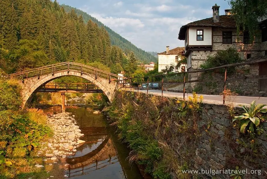
Shiroka Laka is the village to sleep in, one of the prettiest in the Rhodopes, where stone-roofed Revival houses climb a hillside above a river. It is a long-standing centre of Rhodope folk music, with a well-known school of folk arts that teaches the singing and instruments of the region, including the gaida, the bagpipe. A masked carnival, Pesponedelnik, is held before Lent.
The village lies about 23 km from Smolyan and is a protected architectural and folklore reserve. It was founded in the 17th century, and its houses stand in an amphitheatre on both sides of the river, two storeys high with bay windows and wooden staircases inside. Among the best known are the Sgurovska, Uchikovska and Grigorovska houses. The National School of Folk Arts, founded here in the early 1970s, is the reason the village is known across Bulgaria for singing and the gaida. Walk the lanes without a plan, look for the old houses, and stay for the evening, when the village is at its quietest. A night here is better than a stop. The road from Smolyan has had landslides and rockfall in recent seasons, so check its state before you drive.
Opening times:
Village open access
Museums and houses keep their own hours, so check locally
Admission:
Village free
Individual sights vary, so check locally
- Wear shoes with grip for the cobbles. Check the carnival date locally if you hope to see it, and book guesthouses ahead in winter.
Wonderful Bridges
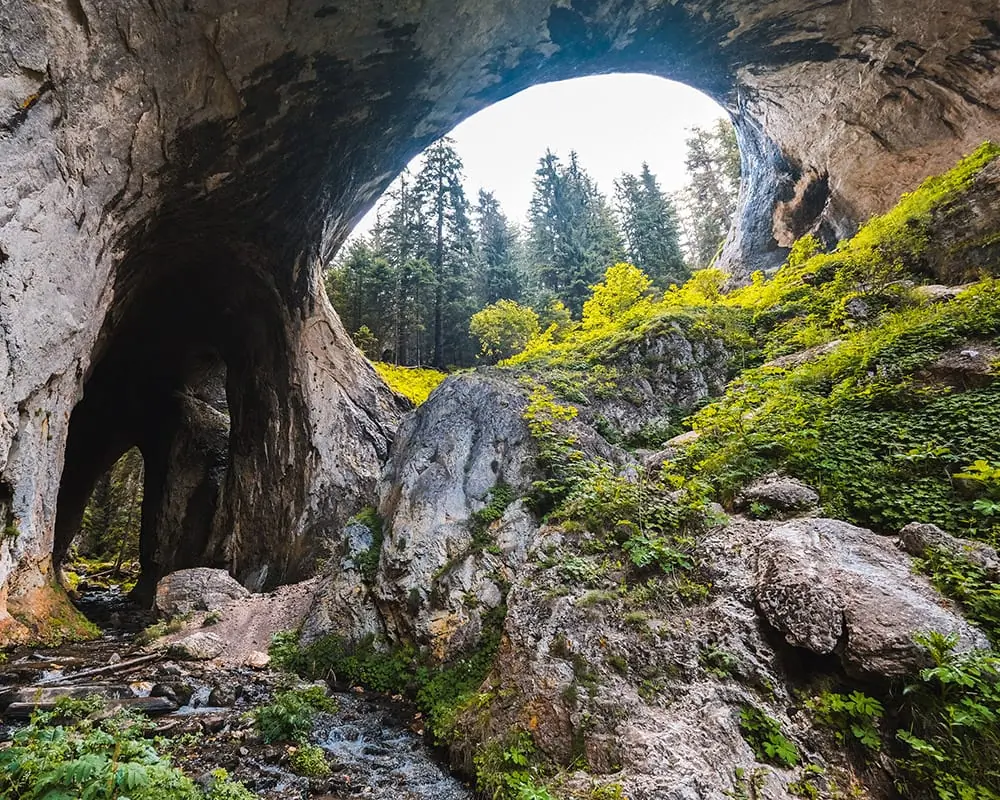
The Wonderful Bridges are the high-mountain outlier. At about 1,450 metres, at the foot of the Persenk peak, two natural rock bridges of marble span the Erkyupriya river valley. They are what is left of a cave whose roof collapsed. The larger bridge is around 96 metres long, with three arches, and the biggest arch is roughly 45 metres high.
It is worth pausing over the scale. That arch is about as tall as a fifteen-storey building and some 40 metres wide, and the bridge above it is as much as 15 metres across. The river carved a cave through the marble over a very long time, and when the roof finally gave way, possibly in an earthquake, these two stone spans were all that was left standing. Stand in the valley and look up through the arches, and you are inside what used to be a cave, with the sky where the ceiling was and the Erkyupriya still running below.
The site has been protected as a natural landmark since 1949, and it is one of Bulgaria’s best-known natural sights. Go early in the day, when the light on the pale rock is softest.
A paved side road climbs to them from the main Plovdiv–Smolyan road. Allow a morning, and go in dry weather. The area has two mountain huts, and hikes lead out to Zaburdo and other villages, so it can also be a base for a longer walk.
Opening times:
Open 24 hours, all year
Admission:
Free
- The access road can be dangerous after rain and in winter, and there is no regular public transport. Go from late spring to autumn, and in dry weather.
Day 9: Trigrad Gorge and the Caves
Shiroka Laka → Trigrad: about 1 h 30
If you have time, the Rhodopes deserve a third day
Trigrad Gorge: the road is one lane wide and cars cannot pass each other, so drive slowly and be ready to reverse to a wider spot.
Devil’s Throat Cave & Trigrad Gorge
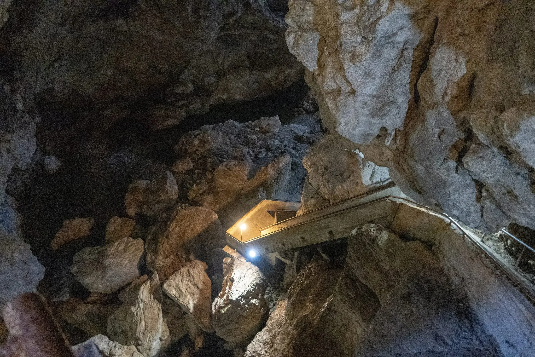
About half an hour or so further on by road from Shiroka Laka, Trigrad Gorge is the dramatic drive: a narrow defile of marble cliffs, protected as a reserve since 1963, with a one-lane road beside the river. At the end the Devil’s Throat swallows the river. A flight of 301 steps leads down beside a waterfall some 42 metres high, the highest underground waterfall in the Balkans, and the sound of falling water fills the cavern.
Local legend holds that Orpheus used the cave to descend to the underworld in search of Eurydice.
The cave has a darker story too. The river pours into the underground and does not give back what it takes: attempts to follow pieces of wood and other objects through the cave have ended with them vanishing without a trace. Tests with dye showed that the water needs more than an hour and a half to reach the cave's other opening, a short distance away. In 1970 two Bulgarian cave divers, Siana Ljutzkanova and Evstati Jovchev, set out to explore the flooded passage below the waterfall. They never came back up, and neither they nor their equipment were ever found. It is reportedly the only attempt ever made to dive it.
The gorge is about 17 km from Devin, and the cave about 2 km from Trigrad village. Go in the morning, and expect the visit itself to be short and the steps to be many. The marble gorge is worth the drive on its own.
Opening times:
Daily, no day off
May–September – 10:00–17:00
October–April – 10:00–16:00
Admission:
| Ticket | |
|---|---|
| Adult | €6.65 |
| Student and senior | €5.62 |
| Child aged 6–16 | €3.07 |
| Under 7, people with disabilities | Free |
- Entry is by guided tour only, and the tour is included in the ticket.
- It is cool inside, so bring a warm layer, and wear shoes with grip, because the steps can be wet. The gorge road is one lane, and cars cannot pass each other.
Yagodina Cave
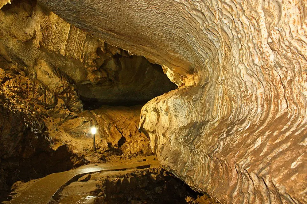
Yagodina Cave is a different mood: a long, quiet cave with a stable temperature of about 6°C all year. It is one of the longest caves in Bulgaria, about 10.5 kilometres by the operator’s own count, and the visitor route covers roughly 1,250 metres of it. People lived in the cave in prehistoric times, and a 360-metre stretch is wheelchair accessible.
What you walk through is old: the cave is estimated at around 275,000 years, and its 22 kinds of formations include some known by nicknames such as Santa Claus and Snow White. Speleologists from nearby Chepelare began exploring it in 1963, and visitors have been coming since 1982 through a man-made tunnel of about 150 metres. Eleven species of bat live inside. Archaeologists have found a dwelling and a pottery workshop from the fourth millennium BC, when people took clay from the cave and the river outside, before an earthquake collapse is thought to have driven them out.
It lies a few kilometres from Yagodina village, about 24 km south of Devin, in a quiet Rhodope valley. The cave is open all year, with a tour every hour, and, as with the Devil’s Throat, the tour is guided. Locals link it too to the Orpheus legend, but as folklore only; the Devil’s Throat holds the more famous claim.
Opening times:
1 May–31 October – 09:00–16:00
1 November–30 April – 10:00–16:00
Tours – on the hour, last at 16:00
Lunch break – around 12:00–13:00 at the caretaker’s discretion
Admission:
| Ticket | |
|---|---|
| Adult | €8 |
| University student | €5 |
| Child aged 6–18 | €4 |
| Under 6 | Free |
| English-speaking guide | €20 |
- Visits are guided, in Bulgarian by default, so ask about the English guide. Be at the main entrance 10 minutes early, and dress warmly.
Day 10: Melnik and Rozhen
Trigrad → Melnik: about 3 h 30
A night in Melnik, then Sofia in the morning: about 3 h
The Struma valley is Bulgaria’s warmest corner, and these two places make a gentle pair: a wine village and a monastery above it. A day trip from Sofia is possible with a driver, but one night is what the place deserves.
Melnik: Pyramids and Cellars
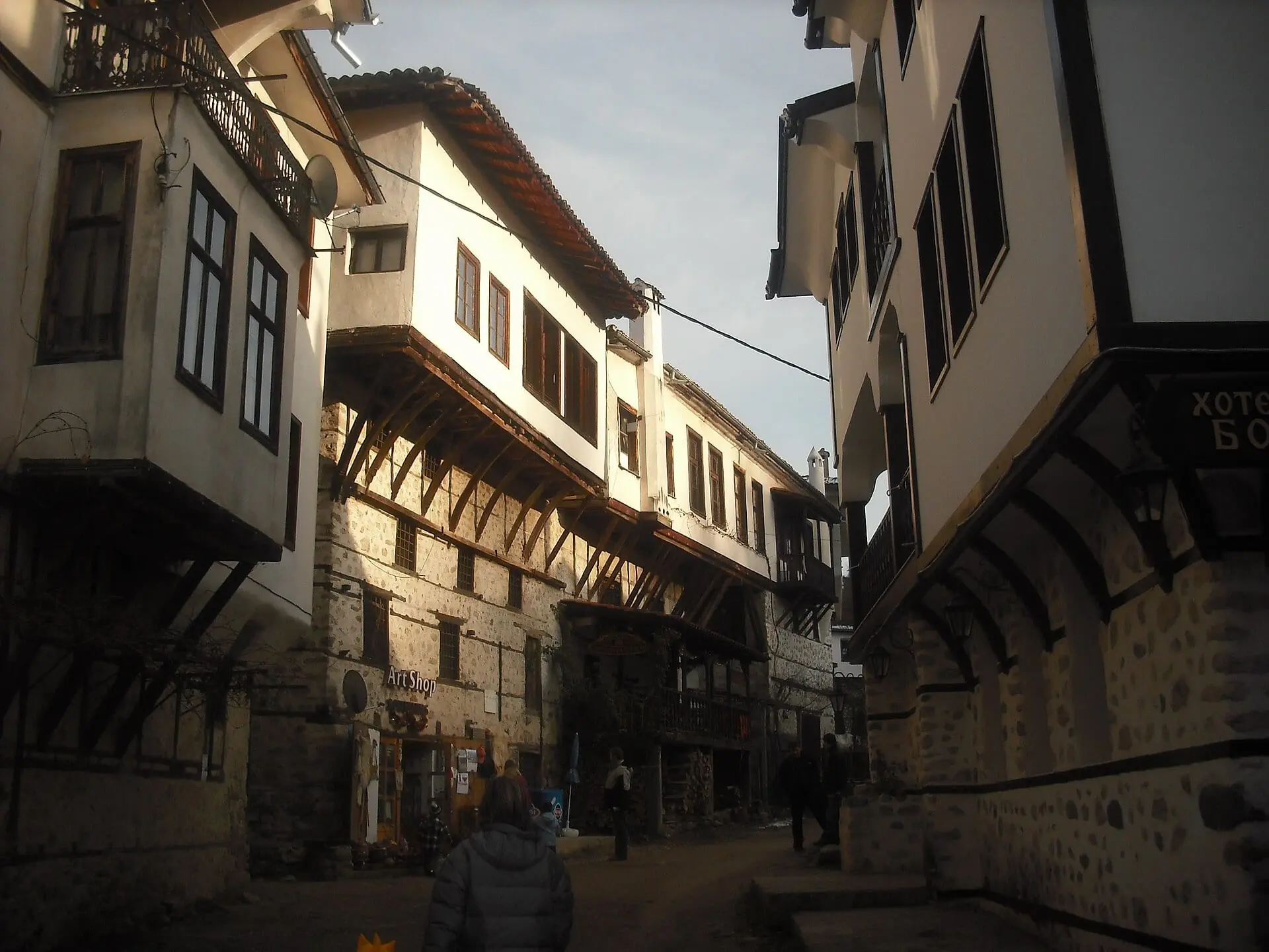
Melnik is built on contrast. It is often described as Bulgaria’s smallest town, a huddle of whitewashed houses along a single main street beneath tall, fluted sandstone pyramids that glow at the end of the day. The cellars are cut deep into the rock to keep the wine cool, and the local red is made from the Shiroka Melnishka loza grape. Melnik was an important trading town in Ottoman times, and its wine travelled a long way.
The shape of a visit is easy. Arrive in the afternoon, wander the lanes and visit the Kordopulov House, a Revival mansion with a large cellar of its own and the grandest stop in town, then take your seat in a family cellar for a tasting and a long dinner. Walk among the pyramids before dusk if you have the energy; the walks start almost at the edge of the village, and the routes are in our hiking guide. Many cellars are small and run by families, so cash helps and weekend bookings are wise. Bulgaria’s limits on drinking and driving are strict, so someone should stay sober for the road, or you should arrange a taxi from the cellar.
Opening times:
| Kordopulov House | Open |
|---|---|
| May–September | 7 days a week |
| March, April, October, November | Wednesday–Sunday |
| December–February | Thursday–Sunday |
Admission:
Kordopulov House – €5
Tasting packages there – from €14
Other cellars – set their own prices
Website:
- Daily clock times are not published online, so ask the house.
- Book ahead at weekends, carry some cash for family cellars, and appoint a driver before you taste. Bulgaria’s alcohol limits for drivers are strict.
Rozhen Monastery above Melnik
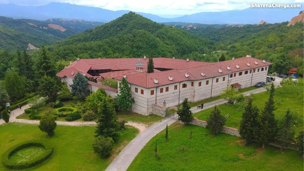
In the morning, drive up to Rozhen Monastery for the cool air and the quiet. A small, working monastery sits on a hillside above the Melnik valley, a short drive from the village along a winding road. Its church carries frescoes, and it is quiet and modest, best in the cool of the morning after a night in Melnik. The setting alone repays the drive up. Sandanski, a mineral-spring town, is the usual stop on the way onwards.
Take care with the name Rozhen. This monastery is in the Pirin foothills. There is also a place called Rozhen in the Rhodopes, near Smolyan and Pamporovo, known for a meadow where a folk festival is held and for its observatory. They have nothing in common but the name.
Opening times:
Daily, all year – 09:00–18:00
Admission:
Free all year round
- Dress modestly, and ask before taking photographs inside. The access road is narrow and winding, so allow extra time.
The narrow-gauge railway: one railway is worth knowing about, and it is a ride rather than a way of getting anywhere: the Rhodope narrow-gauge line from Septemvri to Dobrinishte, near Bansko, calling at Velingrad on the way. At present it runs four trains a day each way and takes about 4 h 30 end to end (€4.29), climbing to 1,267 m, among the highest narrow-gauge lines in Europe. It is a slow, beautiful day out, not a way to get anywhere. Breakdowns sometimes put a bus in its place, and not every service runs the full length, so check the BDZ website before you plan around it.
In ten days you will travel from the red rocks of the north-west, through the caves and rock churches of the north, the Balkan range and the Rhodopes, to the sand pyramids of Melnik. This is the Bulgaria you cannot see from the cities, and that is why the drive is worth it.
Food & Drink by Region
The basic menu is the same across the country, and our country guide covers the dishes. What changes from place to place is the setting and a few regional specialities.
The Rhodopes
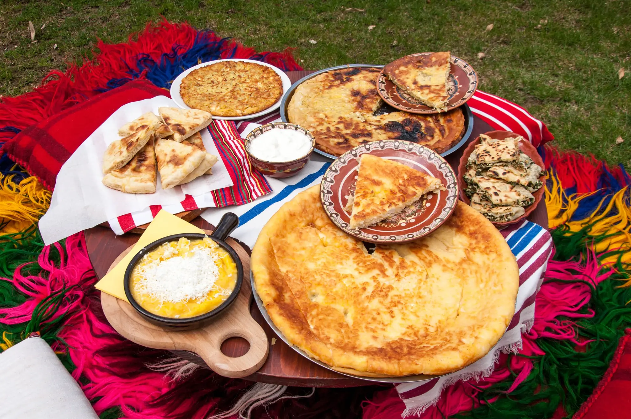
Rhodope cooking is hearty and warming: patatnik, a baked dish of grated potato with savory, kachamak, mountain cheeses, sausages and local honey. After a morning in a cold cave, it is exactly what you want. Many mehanas also serve kavarma, a slow-cooked meat stew often brought to the table in a clay pot.

The village mehana
Rakia is sipped slowly beside a fire in a mehana, the traditional tavern, and the food tastes better for the setting. In a small village such as Shiroka Laka, the mehana is often the only place to eat, so ask your guesthouse. Start with a shopska salad of tomato, cucumber and white cheese, and let the table fill up slowly, because nobody will hurry you.

Melnik
Melnik is about the glass: the red made from Shiroka Melnishka loza, local dry whites, sheep cheese and grilled meats, served in cellars cut into the rock. A tasting turns easily into a long lunch. The driver should skip the wine, or you can book a taxi from the cellar. Many family cellars also pour their own rakia, so ask what the family makes itself.
The north-west
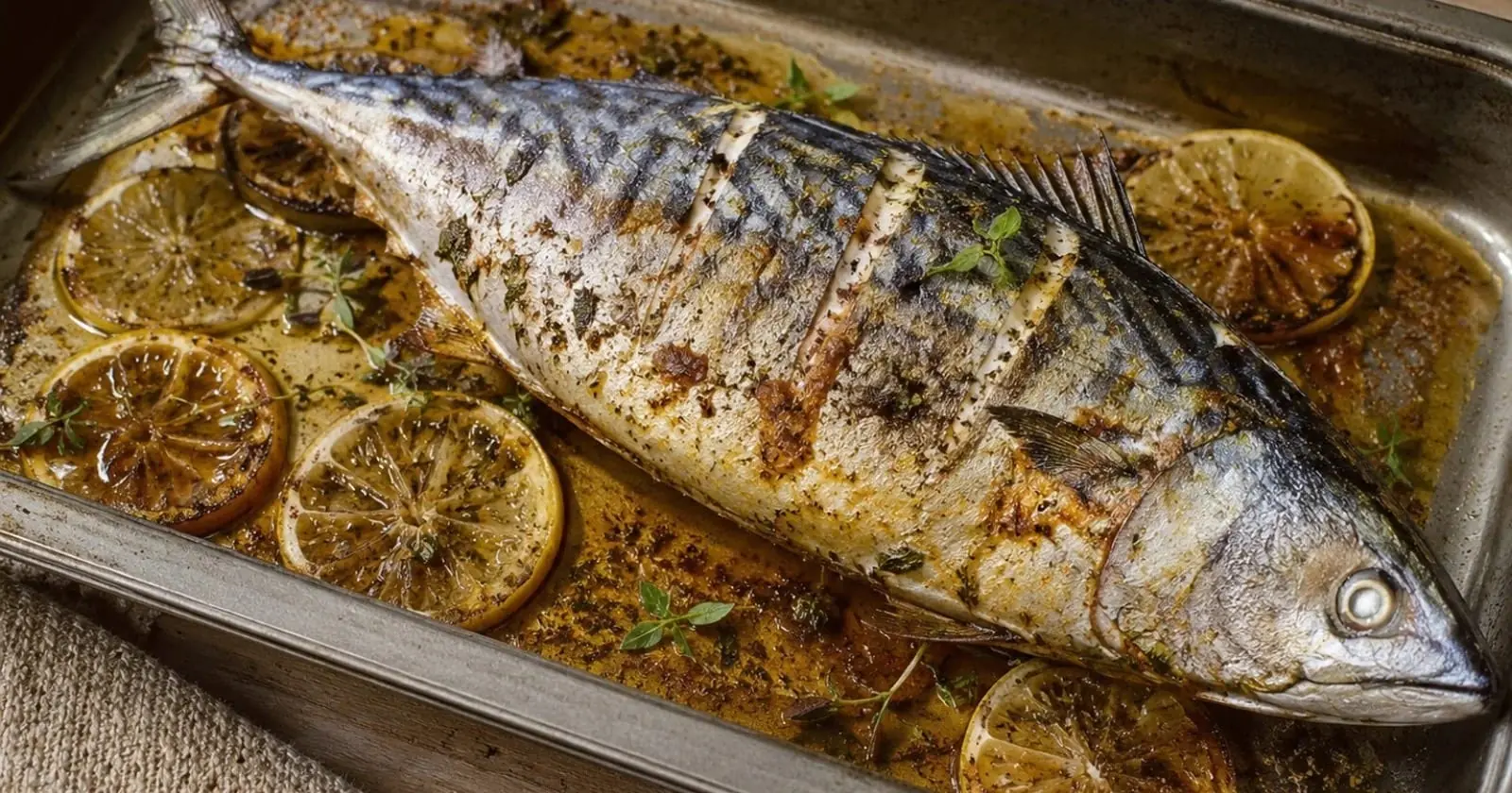
The Danube plain around Vidin is the home of Gamza, a red grape grown in the north-west. Expect Danube fish, plum rakia and hearty village cooking, in small places that close early, so ask your host in advance where you can eat. Gamza is a light, fruity red that is easy to drink, and it suits grilled meat or a plate of local cheese.
Tip: in villages, small places often close early and prefer cash, and menus are not always in English. Ask your guesthouse in the morning where you will eat that evening, and carry a little cash for cellars and cafés.
Practical Tips
Most practical details sit under each place, so only the general points are here:
- Photographing people. Ask monks, worshippers and villagers before you photograph them. Some areas, such as monks’ cells, are closed to visitors.
- Accessibility. The Devil’s Throat has 301 steps, Belogradchik’s fortress has uneven rock, Baba Vida’s western bastion is being reinforced and access may be limited, Ivanovo has steps and a gorge path, and the lanes of Melnik and Shiroka Laka are steep and cobbled. Krushuna has a short walk, and part of Yagodina Cave, about 360 metres, is wheelchair accessible. Check with each site.
- Heat and water. Carry water in summer, especially at Belogradchik and in Melnik.
- In winter, check the state of mountain roads and the equipment rules before you set out; our winter guide covers both.
- Villages keep short hours. Fill the tank in a town, carry a little cash for small cellars, caves and guesthouses, and ask your host at breakfast which restaurants will be open in the evening.
- Safety. These regions are generally safe. Mountain driving is the real risk, so take your time. The emergency number is 112.
Additional Resources
- Visit Bulgaria: the national tourism portal.
- Where to stay: our stay pages for Sofia, Plovdiv, Bansko, Pamporovo and Velingrad.
- Bulgaria as a whole: Discover Bulgaria: Mountains, Monasteries & the Black Sea.
- Cities and day trips: the Sofia guide, with Rila Monastery and the Seven Rila Lakes, the Plovdiv guide, with Bachkovo Monastery and Asen’s Fortress.
- Mountains and winter: hiking in Pirin and Rila and the winter guide.
Book tours and activities
Guided tours, day trips and tickets for caves, villages and monasteries across Bulgaria.
Browse experiencesThe cities are where Bulgaria begins, but these places are where it lingers. Step out of a cave into the light, sit in a cellar while the pyramids go pink, or walk a stone lane in a Rhodope village as the bagpipes start up, and the country starts to make sense.
На добър път! (na DOH-bur PUHT) — Have a good journey!